Today I explored the witches’ ground in the community of Uhlstädt-Kirchhasel, visited a church with medieval fortifications, hiked a steep hill to find castle ruins hidden in the forest, and then raced back to my car before darkness fell and the witches came out.
How to Get There
The fortified church is located in the village of Reinstädt, and the hike started at the village of Dorndorf. Both are located south of Jena off of the B88 highway. If you’re programming your navigation device to find Dorndorf, please note that there are several “thorn villages” in Germany, and this is the one near Uhlstädt-Kirchhasel.

Of Wine and Witches and Ducks
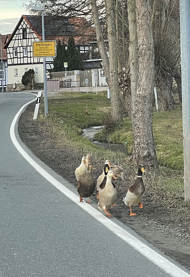
Between the villages of Schmieden and Zeutsch lies a valley referred to by the locals as the “Hexengrund,” literally translated as the witches’ ground. Sadly to say, I saw no witches. I did see a small flock of Indian Runner ducks crossing the road in the village of Heilingen. I slowed down and waited for them, of course.
The word Hexengrund doesn’t really refer to witches, it turns out, but to the so-called “Heckern,” the people who worked in vineyards. The sunny limestone hills of the Hexengrund are perfect for growing wine, and wine grapes grew there for centuries. As far back as 973, it was reported that Emperor Otto II enjoyed the delicious wine of Heilingen. Unfortunately in the 19th century, a Phylloxera outbreak swept through Europe and decimated two-thirds of the vineyards, including those of the Hexengrund. Eventually the vineyards were replaced with fruit trees.
A Church with a Murder Hole
One of the stranger phenomena I came across when I started reading about medieval architecture in Germany is the “Wehrkirche,” or fortified church. To our modern understanding, a church should be a place of peace and contemplation, not a fortress. In the middle ages, though, Christianity was woven into the fabric of feudalism, and monasteries and convents had to defend their fiefdoms just like the nobility did. In addition, not every village had their own fortifications, and a fortified church could do double duty as both a spiritual and a defensive refuge.
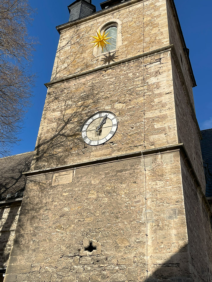
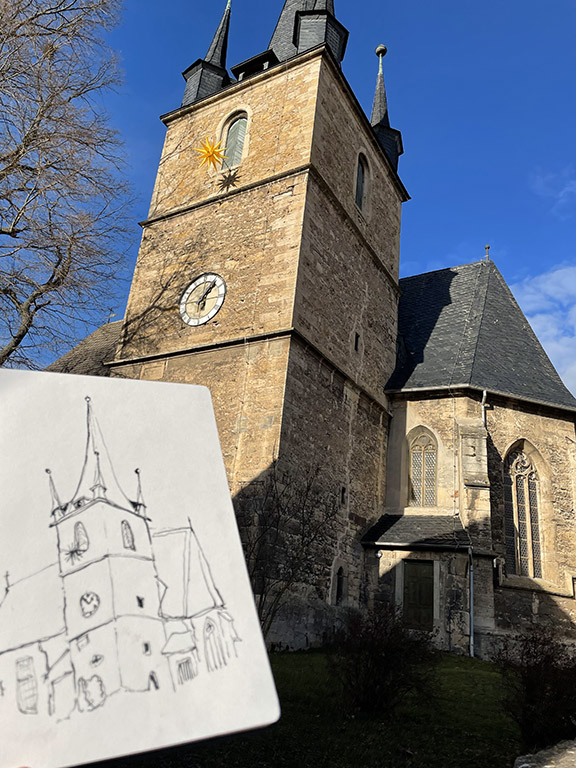
This is St. Michael’s church in Reinstädt. The fortifications are subtle if you don’t know exactly what you’re looking for. The first two photos of the church show a hole in the bottom section of the tower that fits a crossbow. The third photo shows an arrow slit on the left and the murder hole/machicolation (see castle glossary) above the door. A murder hole was used to rain arrows, rocks, or boiling liquids onto besiegers. Currently, this murder hole is being used as a housing for a flood light (4th photo).
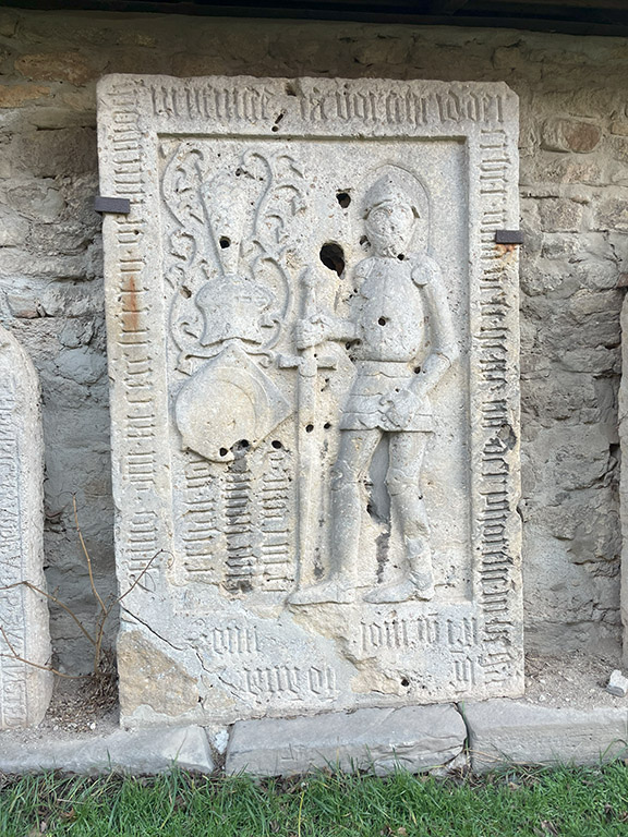
In the garden of the church is a collection of tomb covers that were probably inside the church or crypt at some point. I was particularly taken with one of a knight and his sword. Photo 6 is a just a pretty photo of the church, the blue sky, and a cool tree.


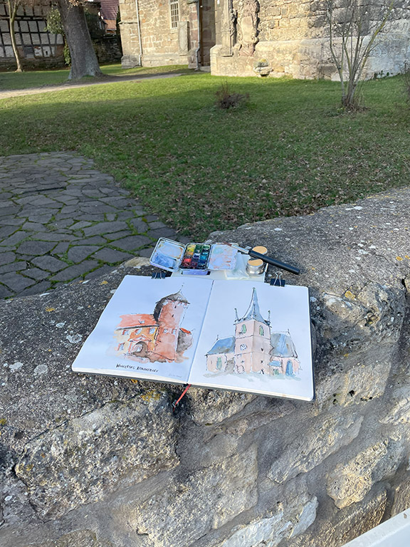
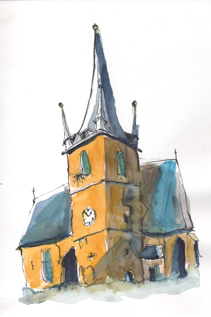
Sketching St. Michael’s
I took some time to enjoy the sunshine and get a quick sketch of the church and the first watercolor wash done before heading to my hiking destination. At home, I added another wash to the sketch. The painting on the right side of the tower got a little muddy and doesn’t demonstrate my best watercolor technique. In my defense, though, I was driven to get rid of the silly peach color of the first wash. In that, I succeeded.
On this late January day, the weather was a balmy 12 °C/54 °F. I didn’t have any worries about ink freezing in my fountain pen or watercolor turning to sludge before I could get it on the page.

Hiking to the Schauenforst Castle Ruins
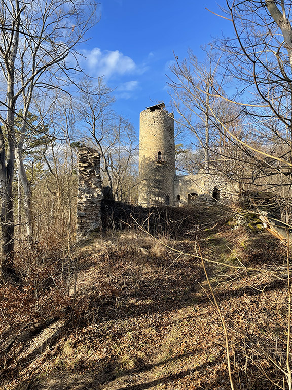
The next stop was the village of Dorndorf, my starting point for a hike to the Schauenforst castle ruins (Burgruine Schauenforst). I managed a 7.3 km/4.5 mile loop hike, but started relatively late in the afternoon at 2 pm. At this time of year, it’s mostly dark by 5pm. The hike took me up one very steep hill and through some muddy, slippery, farm paths, but I managed to get back to my car at dusk. Note to self, plan better.
The origins of the Schauenforst castle are uncertain. The castle dates to the early 13th century, but it’s not known if it was built by Count Hermann II of Orlamünde, or by Landgrave Ludwig IV in a feud with Hermann. At any rate, Count Hermann’s descendant, Count Henry V of Orlamünde lived in the castle from 1338 to 1357. The castle changed ownership multiple times after that. It was reported to already be in a state of ruin by the end of the 16th century, valued mainly for its adjacent vineyards. It’s likely that the castle incurred most of its damage during the Thirty Years’ War (1618-1648).
I would have like to stayed and sketched the castle, but sadly, there was no time.


The endangered Mountain Ash
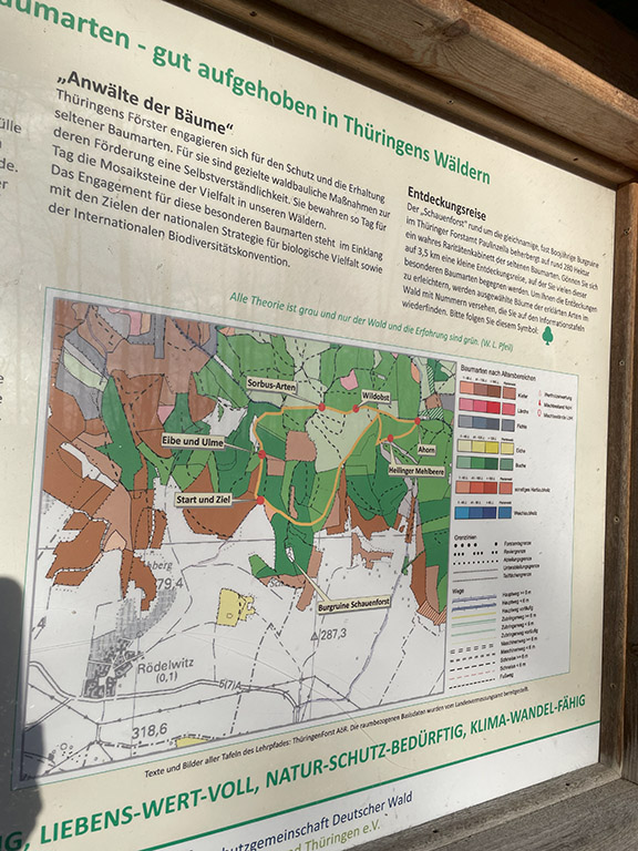
In the forests of the Hexengrund are several rare tree species, including a type of mountain ash called Sorbus heilingensis that only grows in a small area northeast of the village of Heilingen and nowhere else in the world. The largest specimen of this species is under protection as a natural monument. Sorbus heilingensis is designated on the Red List of endangered species in German as extremely rare.
There is a path in the forest (shown on the map below) with information on the rare trees that grow there. Once the forest leafs out in the spring, I would love to return to this area and hike the tree path.
Racing the Sun
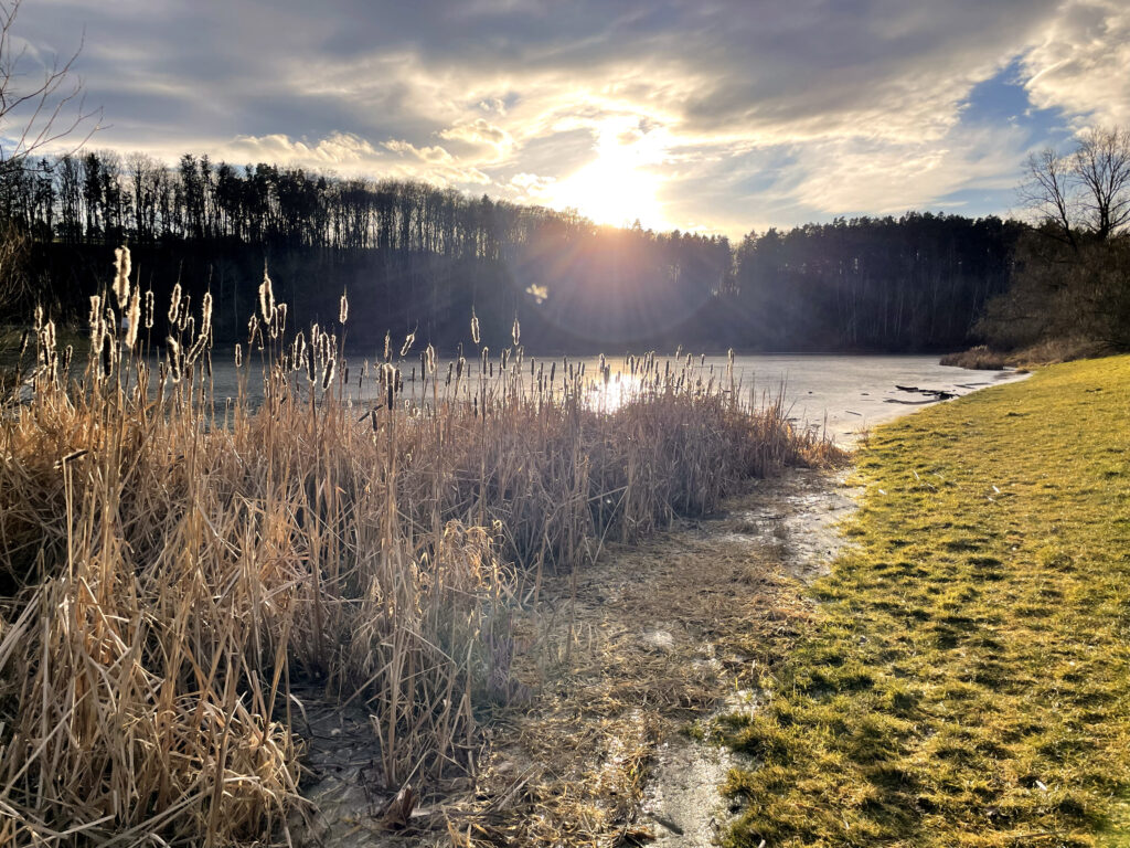
At this point in the hike, I still had about 3 kilometers to go, but who can resist taking a photo of cattails at sunset?
This is the “Talsperra Engerda,” a reservoir near the village of Rödelwitz. You can fish here, if you have a license, but you’re not allowed to swim.
I did manage to make it back to my car before dark. On the drive home, I had plenty of time to contemplate why I shouldn’t trust the Komoot app for finding trails. It’s led me astray before and sent me down trails that weren’t actually official trails but paths through bushes or a farmer’s field. Once I was encouraged to enter a field clearly marked as an enclosure for a bull, and I decided that was a bad idea. Tramping through brush is also questionable. You might accidentally wake a sleeping boar and find yourself running from teeth and tusks. From now on, I’m going to spend more time verifying the trails. There are many hiking trails in German and most are well-marked with trail blazes and signs.
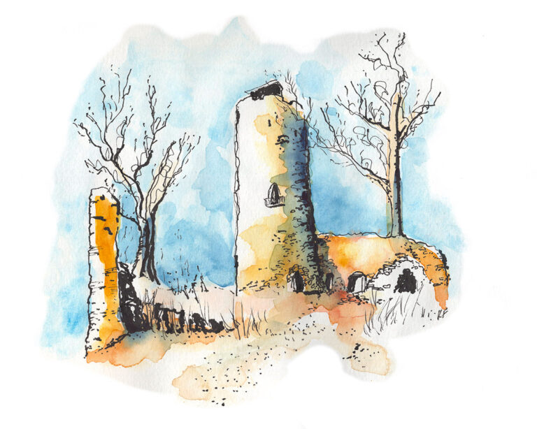
Sketching from Photos
As I wasn’t able to sketch on-site because of time constraints, I sketched this drawing of the castle ruins of Schauenforst when I was at home.

That’s it for this post. I managed to get a real hike in, if rushed, and I saw a part of Thuringia that I’ve never experienced before. It’s fascinating to poke around these little villages. I want to come back in the spring to hike the tree path, but also, I saw some gorgeous vistas in the villages of the Hexengrund with old stone bridges and half-timbered houses begging to be sketched.
If you’re a hiker and have a trail app for Germany that you trust, or if you’re simply fascinated by the Hexengrund, or if you know some interesting stories from this part of Thuringia, please let me know in the comments.
The information on Sorbus heilingensis is a little outdated/incorrect.
It is now considered a local occurence of a Sorbus aria x torminalis hybrid and no longer a species of it’s own.
Thank you for that updated information!